L2 processor for GK2A - Satellite Meteorological Data Processing System
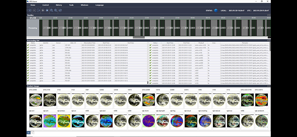
Globe mP SMDPS (Satellite Meteorological Data Processing System) produces Level 2 products from Geostationary Weather satellite transmission that can be used in Forecast, Disaster mitigation and monitoring. This include Cloud, Rain fall, Fog.
KMA’s successful GK-2 Meteorological Data Processing technology is applied to Soletop’s commercial Globe mP products. This product includes server computer that collect and process imagery in addition to Network storage and Switching hub.
Level 2 products such as Cloud detection, Cloud analysis, Icing, Snowfall, Fog, Aerosol, Land surface temperature, Sea surface temperature etc. can be produced. In addition, user defined Level 2 Algorithm and scenario can be applied. HDF5 is used as basic output data format but user can define other formats such as PNG and JPEG.
This product is designed to work with GlobeShotTM PLUS Geostationary satellite reception system to fully automate the entire reception and product processing pipeline up to Level 2. No user intervention is necessary after the automation starts.
Current products are Cloud detection, Cloud analysis, Cloud temperature and height, Fog, Aerosol detection, Aerosol optical thickness, Precipitation rate, Rainfall, Upper tropospheric humidity, Land and sea surface temperature, Sea/Ice detection, Atmospheric moving vector, Total and Solar radiation.